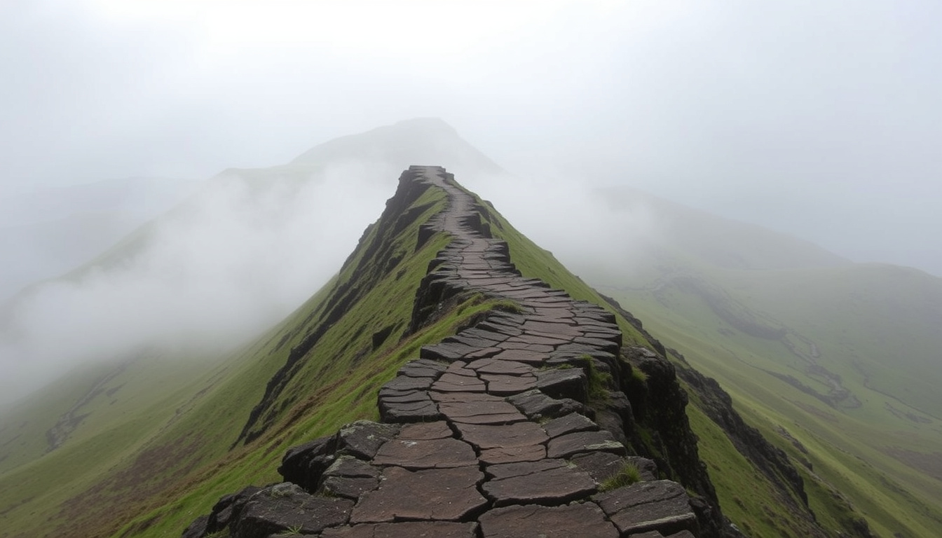
Mam Tor rises above the village of Castleton in the Peak District, offering one of the most popular circular walks in the national park. Known as the Shivering Mountain because of its active landslips, this 517-metre hill combines dramatic geology, panoramic ridge views, and a stretch of abandoned road that tells a story of ongoing natural change.
The standard circular route starts from Mam Nick car park, climbs stone steps to the summit, follows the ridge toward Hollins Cross, and returns along the broken remains of the old A625. With a distance of roughly 5.2 miles on the National Trust route, the walk typically takes between 2.5 and 3.5 hours depending on pace and stops.
Mam Tor sits on an active landslide that moves about a quarter of a metre per year on its southeast side. The nickname Shivering Mountain comes directly from this instability, and the abandoned road section — closed after major landslips in the 1970s — remains the most striking evidence of the ground shifting beneath walkers’ feet. If you are planning a broader UK trip, you may also enjoy our guide to What to Do in Edinburgh – Complete Travel Guide for 2025.
What is the best Mam Tor circular walk route?
Castleton, High Peak, Derbyshire
517 m (1,696 ft)
5.2 miles (circular)
Moderate
The most commonly described route follows a clear pattern and is well suited to walkers with a reasonable level of fitness. Several sources describe the walk as easy to moderate, with an elevation gain of roughly 177 metres.
- Mam Tor is one of the most popular walks in the Peak District for its panoramic views and moderate challenge.
- The walk is suitable for families with proper gear, but weather can change rapidly – check the forecast before setting off.
- The Mam Tor landslip, active since the 1970s, makes a dramatic and educational stop along the route.
- The stone-surfaced path from the car park to the summit offers one of the most dramatic vistas in the Peak District.
- Walkers typically start at Mam Nick car park, climb steps to the summit, continue along the ridge toward Hollins Cross, descend, and return via the broken road.
- Alternative longer routes extend from Castleton or Edale toward Kinder Scout or Back Tor, but these are separate hikes beyond the standard circular.
| Fact | Detail |
|---|---|
| Height | 517 m |
| Name meaning | Mother Hill (also Shivering Mountain due to frequent landslips) |
| Walk length | 5.2 miles circular (National Trust route) |
| Start point | Mam Tor Car Park or Castleton |
| Nearest town | Castleton |
| County | Derbyshire |
| National park | Peak District |
| Key feature | Active landslip, abandoned road, panoramic ridge walk |
How long is the Mam Tor walk?
The National Trust circular route is listed at 5.2 miles, with most walkers completing it in 2.5 to 3.5 hours. Other sources describe a shorter loop of around 3 miles that follows a similar trajectory. The variation depends on which path is taken and whether walkers include the full ridge section.
How do I get directions to Mam Tor?
The standard route begins at Mam Nick car park, located on the A6187 just west of Castleton. Walkers climb the stone steps directly from the car park to the summit, follow the ridge northeast toward Hollins Cross, descend, and loop back along the base of the hill past the abandoned road section before returning to the car park.
Is Mam Tor dangerous?
Under normal weather conditions and with proper footwear, the Mam Tor circular walk is not considered dangerous. The main risks come from rapidly changing weather, slippery paths in wet or icy conditions, and the ongoing landslip activity on the southeast side of the hill.
The National Trust route notes recent rockfalls near Windy Knoll Cave and advises against entering the cave. Walkers should also be aware that the path to the old road is closed in some sections due to landslip movement, and local signage should be followed. For detailed mountain conditions, the Met Office Peak District forecast is a reliable resource.
What is the Mam Tor weather forecast?
Late spring to early autumn generally offers the clearest views and mildest conditions. Wet, icy, or snowy weather can make paths slippery quickly. The walk is doable year-round, but proper footwear and waterproof layers are essential outside the summer months.
Weather in the Peak District can change from fine to hazardous within 30 minutes. Always bring layers and waterproofs regardless of the morning forecast, and check conditions before setting off using a dedicated mountain forecast service.
Is the path safe near the landslip?
The landslip remains active, with movement averaging about a quarter of a metre per year on the southeast side. Walkers are advised to stay on marked paths, avoid the closed sections of the old road, and not enter any caves or fissures along the way.
Where is the best Mam Tor car park?
Mam Nick car park is the closest and most convenient parking option for the standard circular walk. It sits directly below Mam Tor, giving immediate access to the summit path. However, it is small and fills quickly, especially at weekends and during peak holiday periods.
One guide notes a paid parking rate of £4.50 for up to 4 hours, while another mentions charges around £2.50 for 1–2 hours. These figures may vary over time, so current rates should be checked before travel. There are no facilities or toilets at Mam Nick car park. For more details on the area, the Peak District National Park Authority website offers guidance on parking and access.
Is there free parking near Mam Tor?
Free on-street parking is limited in the area. Alternatives such as parking in Castleton or Edale extend the walk considerably. Castleton offers more parking spaces and toilet and cafe facilities, but adds roughly a mile of walking each way to reach the Mam Tor summit path.
Mam Nick car park fills early on weekends and bank holidays. Arriving before 9 a.m. is the most reliable way to secure a space. Later arrivals may need to use Castleton or Edale parking and factor in the extra walking time.
How busy is Mam Tor car park at weekends?
Multiple sources describe Mam Nick car park as small and subject to high demand. On sunny weekends in spring and summer, the car park can be full by mid-morning. Planning an early start or visiting on a weekday significantly improves the chances of finding a space.
Why is Mam Tor called the Shivering Mountain?
The name Mam Tor means Mother Hill in a local dialect, but its more evocative nickname — the Shivering Mountain — comes from the active landslips that continuously affect its slopes. The geological instability is visible in the broken ground on the southeast side and in the abandoned road that once carried the A625. For a broader overview, the Wikipedia entry on Mam Tor provides further historical and geological context.
Mam Tor sits on an active landslide composed of shale and gritstone. The movement is driven by water lubricating layers of weak shale beneath the more resistant cap rock, causing the southeast flank to creep downhill at an average rate of about a quarter of a metre per year.
What happened on the Mam Tor landslip?
The A625 road beneath Mam Tor suffered frequent landslips throughout the 1970s. Despite repeated repairs, the cost and frequency of the damage became unsustainable, and the road was officially abandoned in 1977. The broken road surface now forms a dramatic section of the walking route, with large slabs of tarmac tilted and cracked by the shifting ground.
What is the geology of Mam Tor?
Mam Tor is formed from a cap of hard Millstone Grit overlying softer shales. The contrast between the resistant gritstone and the eroding shale beneath creates the conditions for the ongoing landslip. The summit itself is stable, but the southeast side continues to move, creating the distinctive hummocky ground visible today.
When did the Mam Tor road close?
- Ancient period: Mam Tor summit was used as a Bronze Age hill fort, with earthworks still visible today.
- 1970s: Frequent landslips on the A625 road beneath Mam Tor required repeated repairs.
- 1977: The road was officially abandoned after repair costs became unsustainable.
- Present day: The landslip remains active, and the path is diverted via Winnats Pass for vehicular traffic. Walkers use the broken road section as part of the circular route.
Is the Mam Tor walk safe in all weather?
| Established information | Information that remains unclear |
|---|---|
| Mam Tor is safe to walk under normal weather conditions when following marked paths. | Landslip activity is ongoing — the path to the old road is closed in places; check local signage before walking. |
| Proper footwear and waterproof layers are essential in wet or cold conditions. | Weather can change from fine to hazardous within 30 minutes — always bring layers and waterproofs. |
Where is Mam Tor located and why does it matter?
Mam Tor sits at the western end of the Hope Valley ridge, directly above the village of Castleton in Derbyshire. Its position within the Peak District National Park and its proximity to Castleton — a popular tourist village with shops, pubs, and the Blue John Cavern — make it one of the most accessible hill walks in the region. The Visit Peak District website offers further information on local attractions and accommodation.
Visitor pressure at Mam Tor is high because of this accessibility combined with the dramatic geology. The car park fills early on weekends, and the path can be busy during school holidays. The combination of history — a Bronze Age fort — and natural beauty, including the abandoned road and panoramic views, makes it a unique destination within the national park.
The walk is also a gateway to longer routes. From Mam Tor, walkers can continue along the ridge toward Kinder Scout or Back Tor, though those are separate, longer hikes rather than the standard circular. For more UK travel inspiration, see our guide to What to Do in Edinburgh – Complete Travel Guide for 2025.
What do official sources say about Mam Tor?
“Mam Tor circular walk is 5.2 miles, taking in tree-lined avenues and heather-covered moors.”
— National Trust
“The name Mam Tor means Mother Hill; the landslips gave it the nickname Shivering Mountain.”
— Peak District National Park Authority
What should I know before visiting Mam Tor?
Plan to arrive early, especially at weekends, to secure parking at Mam Nick car park. Check the weather forecast before setting out, pack waterproofs and sturdy footwear, and stay on marked paths — particularly near the landslip section. The walk is suitable for families and dogs on leads, and toilets and cafes are available in Castleton village before or after the walk. The Ordnance Survey map of the Peak District covers the area and is recommended for navigation in low visibility.
Frequently asked questions about Mam Tor
Can I take my dog on the Mam Tor walk?
Yes, dogs are welcome on the Mam Tor circular walk. Keep them on a lead near sheep and livestock, which graze on the hillside.
Is Mam Tor suitable for children?
Yes, children can complete the walk with proper footwear and weather awareness. The stone steps and clear paths make it manageable for older children, but the ridge has steep drops in places.
How long does the walk take?
The National Trust circular route takes 2.5 to 3.5 hours depending on pace, photo stops, and weather conditions. The shorter 3-mile route may take 1.5 to 2 hours.
Are there toilets or cafes nearby?
There are no facilities at Mam Nick car park. Toilets, cafes, and pubs are available in Castleton village, about a 10-minute drive or 1-mile walk from the car park.
Do I need to pay for parking at Mam Nick?
Yes, Mam Nick car park is a paid car park. Rates have been reported at £4.50 for up to 4 hours and £2.50 for 1–2 hours, but prices may vary — check current charges before you go.
Can I walk Mam Tor from Castleton?
Yes, you can walk from Castleton to Mam Tor, but this adds roughly a mile each way. The route from Castleton goes via Winnats Pass and joins the main circular path near the summit steps.
Is the abandoned road section safe to walk on?
The broken road is part of the standard circular route and is generally safe to walk on in dry conditions. Avoid any closed sections and do not enter caves or fissures near the landslip area.
What is the best time of day to walk Mam Tor?
Early morning, before 9 a.m., offers the best chance of securing parking and seeing clear views before cloud builds. Late afternoons in summer also provide good conditions and softer light for photography.
Do I need a map for the Mam Tor walk?
The path is well signposted and easy to follow, but carrying a map or using a mobile app is recommended, especially in misty or low-visibility conditions. The Peak District Ordnance Survey map covers the area.
Can I combine Mam Tor with other walks?
Yes, from Mam Tor you can continue along the ridge to Back Tor or Loschill, or extend the walk to Kinder Scout. These are longer, more challenging routes requiring additional time and preparation.

Rebecca Haines is Managing Editor at DailyCity.co.uk, running the daily news list and covering UK and world stories with a city lens.